Tuesday, January 30, 2007

Projects: Coops, Candles, and Cannons

We've been in our house for a month and a half and are still settling in. Virginia (my totally groovy wife) has been priming and painting like a madwoman. I've been cooking up a storm...nothing like garlic and onions to exorcise the fragrance of the former owners. Okay, Smell is an important variable in home-ownership.

Speaking of which, today I undertook the cleaning of the tiny henhouse that I'd like to eventually turn into a forge/workshop. After two hours of pretty loathsome work I made a dent and also got a sneak preview of purgatory. Several years worth of accumulated chicken droppings approximate a sort of ersatz concrete...not quite cement, not quite organic...definately not fun. I picked the coldest day of the year (thus far) to tackle this task as the molecules would be moving VERY SLOWLY (read "not smell so bad"). If I can salvage this structure, and I'm sure that I can, I'd like to have a space to do some rudimentary blacksmithing (Youtube forthcoming on this subject).

Beyond home improvement, I'm still trying to find time to edit a Youtube movie about the 18th annual Antietam Illumination. This project seems to get pushed further and further back on the rearmost burners.

I'm also percolating a second blog installment regarding the growth of Antietam National Battlefield over the years, especially the physical evidence that remains of recent changes in the park, those of the last 15 years of so. Evidence includes pavement leading to nowhere, abandoned boundary lines, and tumble-down chicken coops.
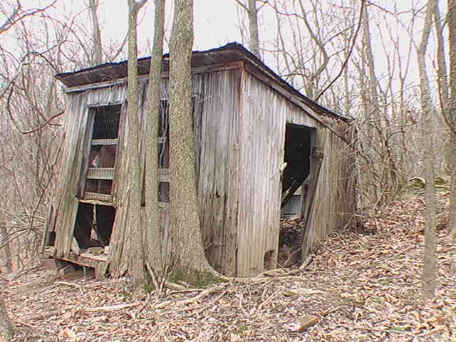
So now I've come full circle.

In other developments, a new reproduction gun carriage has been delivered to the Burnside Bridge parking area. This beauty is going to be teamed up with one of our rifled tubes (one of those occasionally thought to be "abandoned" by some visitors) in our maintenance yard.

pretty!


The completed gun will probably be used to represent the position of George W. Durrell's battery during the Ninth Corps attack on the bridge and advance to Sharpsburg.

Yesterday I gave an orientation talk that fairly typifies the winter season at the park. I had just two people, a married couple from Illinois. They asked the best questions that I've ever been asked by visitors. It never ceases to surprise me, how many regular people (neither authors nor bloggers) have a passionate, and open-minded, interest in America's Civil War. Like me, they were Midwesterners, and like me, they had grown up on the prejudices of the historians of the 1950s and 60s.

For my talks these days, I prop up my two photos of Lee and McClellan and remind them that Lee was not the infallible saint that the "lost cause" historians have left us with, nor was Mac the cautious idiot that the historians of the centennial era (Palfrey not withstanding) painted for us. History is always much more complicated, and interesting than the dumbed-down versions, and the American Civil War is one VERY interesting story. They liked that.

I'll keep you posted.

Mannie

Friday, January 26, 2007

Burnsides Bridge: a new perspective part two

(click on views to enlarge)


Burnside Bridge: two views. Above, September 1862 (Alexander Gardner).
Below, January 2007 (Ranger Mannie).


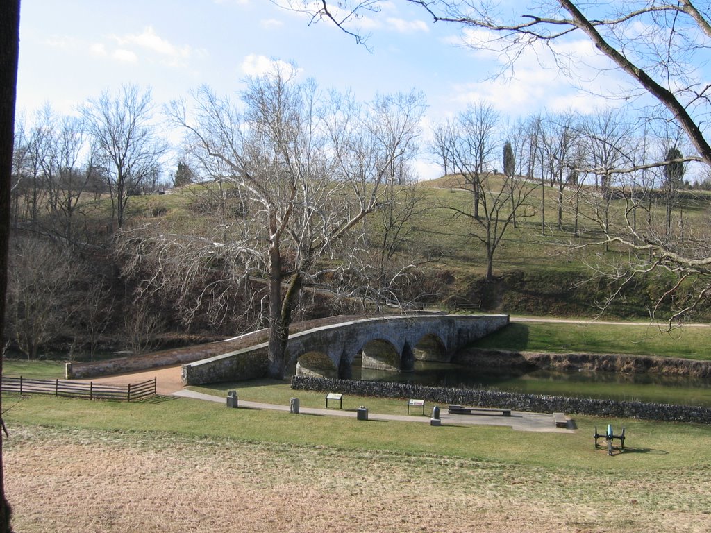
At the risk of putting too fine a point on this issue, I'd like to add to my recent post regarding the viewscape cut above Burnside Bridge. I went back to the bridge yesterday with a higher resolution camera to capture additional images. It was a beautiful mild and sunny day, and the light at 10:00 a.m. was ideal for a good shot of the bridge.

In this view, approaching the bridge from the Confederate side, look across Antietam Creek and you can see where the viewshed has been cut. The new trail runs along the crest of the hill. An inch above and slightly to the right of the distant howitzer you can just make out a rock outcropping.


That outcropping (as well as the viewshed) becomes even more apparent as you continue to approach it from the Union side of the bridge. It's dead center, just below the crest. That outcropping is actually another quarry-pit where stones were harvested to construct the bridge, just like the similar pits that Toombs' rebels used as rifle pits on the Sharpsburg bank of the creek. This pit came as quite a suprise to all of the rangers as it has been hidden in the underbrush for many generations.

On reflection, it only makes sense that stone was harvested from both sides of the creek to construct the bridge.


Marching up the steep slope, past the new tree stumps, I headed toward that quarry pit. As I hiked up the hill It occurred to me that this terrain that Ferrerro's men came charging down is incredibly steep, which probably gave them an incredible amount of momentum (providing they could retain their footing).

Upon gaining the quarry pit I noted that the floor of it was quite level...a perfect place to set up a tripod-mounted camera. As I turned around to face the bridge I realized that I was standing on the same spot at which Alexander Gardner captured his historic image.


Every day at Antietam brings new suprises.

I love this place, you will too.

Ranger Mannie

Monday, January 22, 2007

Winter comes to Dixie

(Gun of Capt. Tomkins Rhode Island Battery)


Yesterday, as I was driving to the park, the snow started to fall just as I crested Cemetery Hill heading into Sharpsburg. Parking at the Smith House, I began my morning routine. After a vigorous 45 minute walk through the West Woods and back to the Visitor's Center it became clear that this snow was going to stick around for awhile. As the slow winter season day passed, the snow continued to accumulate, not much by Michigan standards (we're talking about an inch here), but, for this region it had folks quite concerned, so much so that the park closed an hour early.

I changed out of my uniform somewhat bemused with the hulabaloo that this light snowfall was met with..

This morning I went in to the park an hour early, so as to get my walk in, and I was greeted by a lovely carpet of light snow, untrammeled save for the wildlife of the valley.

As I hiked from the tower at the Sunken Road to the Roulette Farm, I picked up the trail toward the Mumma farmstead following the ever gurgling spring that flows quite mysteriously from out of nowhere on the Mumma Farm and flows down to the Antietam. In a single glance I could see the bright green grass of spring, the withered leaves of Autumn and the fresh snow of winter.

This battlefield is beautiful in all seasons.

Do come visit...just north of Sharpsburg

Ranger Mannie

Thursday, January 18, 2007

Burnside Bridge: A New Perspective

(Alexander Gardner 1862)

Actually, I guess I should say that an old perspective returns.

As I mentioned in my last post, three new trails are under development at Antietam National Battlefield. One of which focuses on the Union approach toward, and the storming of, Burnside Bridge.

This morning I drove down to the bridge, as I've heard that the fine folks from the Natural Resources Division of the park have been doing a lot of trail work down there, so I wanted to check it out. Just so you know, the talented crew of the Natural Resources Division is responsible for many aspects of the park, especially the one which causes innumerable visitors to exclaim "What a breathtakingly beautiful place!" That's Natural Resources.


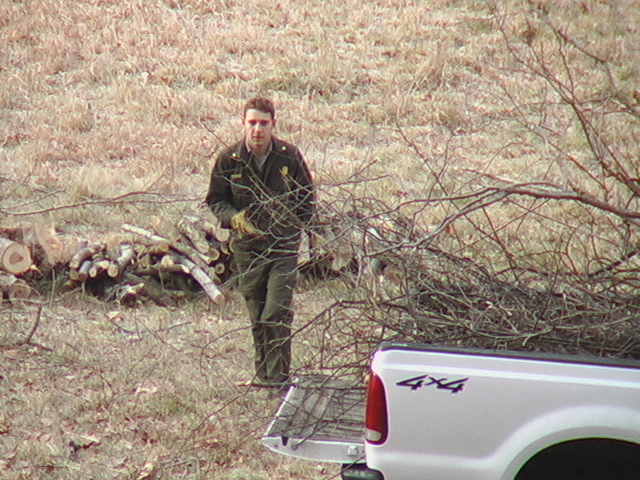
From the parking lot (stop 9 on your driving tour) I could see a park truck and four of the Natural Resources folks gathering up brush.


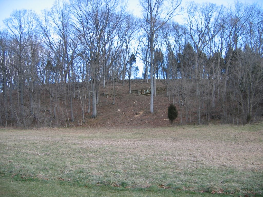
As I looked closer I saw the flashes of the newly cut stumps marching up the hillside that the Federals had come charging down (Ferrero's troops), and it was evident that more than just the trail had been cut.


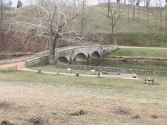
An expansive and fantastic viewshed has been cleared providing a vista of the bridge from the Union side that hasn't been available since the days of Alexander Gardner...and I got the first modern shot of it.

This trail opens in late spring.

Enjoy the view.

Ranger Mannie

Tuesday, January 16, 2007

My, how you've grown!

Seems that more often than not, what we read about the current state of battlefield preservation is one set of threats after another. The cliche headline invariably reads "Developers and preservationists engage in the second battle of (insert name here)". The pressure of constructing more bedrooms for Washington D.C. commuters, the current passion for enormous single-family homes, and the rapacious bulldozing by unscrupulous developers all continue to threaten America's most significant battlegrounds.

For some good news, reflect upon the quiet and steady growth of the jewel in the crown of the National Park Service: Antietam National Battlefield.

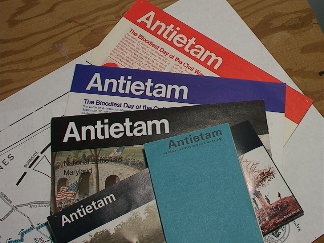
I recently unpacked (we've just moved) the Antietam brochures that I've been collecting since I first visited the battlefield with my father in 1968. A comparison of one to the next, to the next, is both instructive and very encouraging.


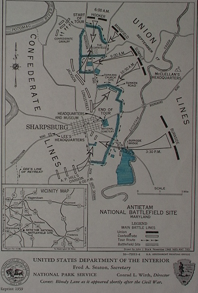
This brochure was recently given to me by someone a little older than me. The map of 1948 (reprinted in 1959) depicts a park not much larger than the original authorization of 40 acres, including the National Cemetery. Originally the park consisted merely of the cemetery and the right-of-way along the battlefield road (in blue). This tiny footprint was later slightly enlarged to include the fields south of Burnside's Bridge. Note that the Hagerstown Pike still zoomed right through the heart of the Dunker Church/Cornfield area. Burnside's Bridge was still open to vehicular traffic at this time and the bypass around the bridge did not yet exist. The Cemetery lodge still served as headquarters, museum, and visitor's center. This was the period when the Dunker Church rose again, in its original location, with much original material, just in time for the Civil War Centennial.


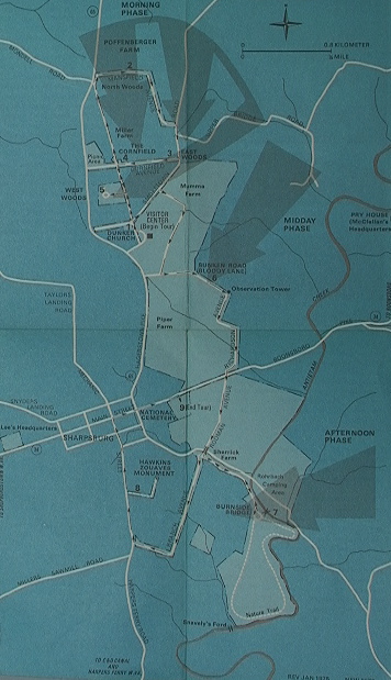
The tiny, blue brochure of 1972 (revised 1975), an abbreviated, three-color cheepie reflecting our federal financial burden in Southeast Asia.

But what remarkable changes have occurred; The highway bypass now routes Hagerstown-bound traffic around, rather than through, the park. Similarly, motorists no longer cruised over Burnside's Bridge; a bypass was built to skirt it.

Note the still-skeletal nature of the areas around the Cornfield and Branch Avenue. Otherwise quite a lot of acreage had been added including the Mumma, Piper, and Sherrick farms. By this time the beautiful (and current) "Mission 66" visitor's center had been built. Other visitor amenities included the picnic area near Philly park and a nature trail.

No sign yet of the Pry House.


Another cost-cutter; the blue (later red) brochure of the 1980s. This fairly muddy map premiers the tour route in use today with stops 1 through 11 just as visitors still encounter them.

The Cornfield and Branch Avenue retained their War Department-days appearance but The Otto House, Pry House, and Roulette Farm had been acquired. The former nature trail evolved into the Snavely Ford Trail.


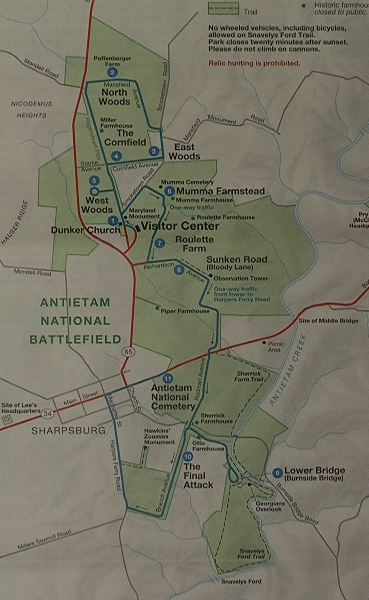
The Park welcomed the Poffenberger farmstead with this 1995 map. And look at the growth! The battlefield now extends across the 65 to the base of Hauser Ridge. The North Woods is included in the footprint and the West Woods is finally, and securely in Federal hands (get it?). Also note the incremental growth of the Pry house holding. This characterizes the beginning of the "boom time" battlefield expansion.


The 2003 map sees the addition of the fields to the east of the Sunken Road a huge tract extending to Antietam Creek, just as the Pry House acreage now extends westward to the creek.

The Sherrick Farm Trail has been established and land is acquired along Mondell Road nearly to the base of Nicodemus Heights.


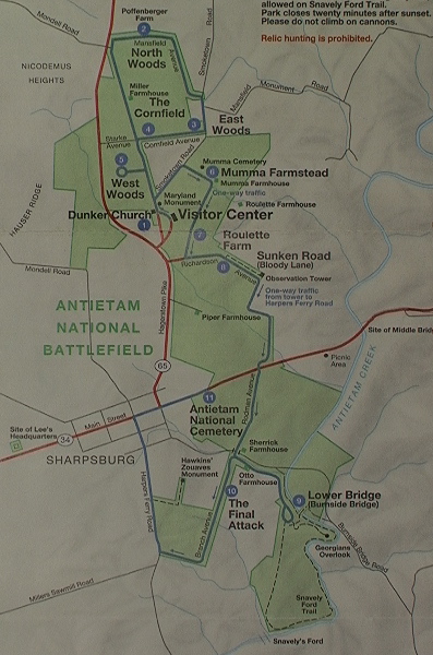
Now comes my year (the one of living rangerously). The current map is the 2004 printing. Note the welcome addition of the Cornfield trail.

In 140 years the park has grown from a meager 40 acres to just over 3,000 acres today, and not at the expense of the park's good relations with the surrounding community. The people of Sharpsburg have long embraced the significance of the battlefield. Area farmers have always been agreeable to selling out to the park when they retire from tilling the fields. Many their children still plant and harvest those fields under a very mutually beneficial leasing agreement with the Park.

How ironic that the scene of America's greatest calamity 144 years ago is now such a peaceful and agreeable place, with so many diverse people and interests working toward the same preservation goal.


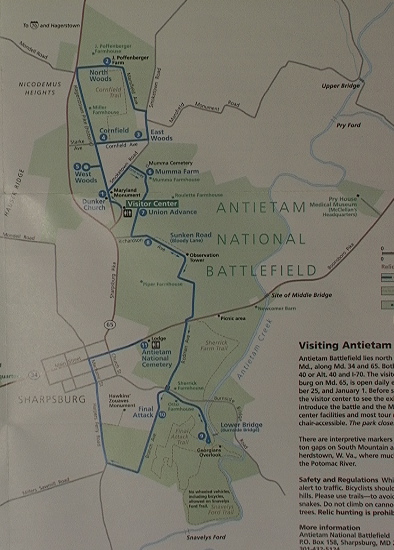
Hey!...wait a minute...this brochure's not out yet. O.K. just a peek at the new brochure, note the new Final Attack trail. What's more, come April of 2007 three more new trails are slated to open.

In the Antietam Creek Valley lots of good people and organizations are working together, every day, to preserve this battlefield and the memories of those who sacrificed so much for all of us.

Sometimes, growth is good.

Come visit (and save your brochure).

Ranger Mannie